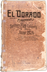
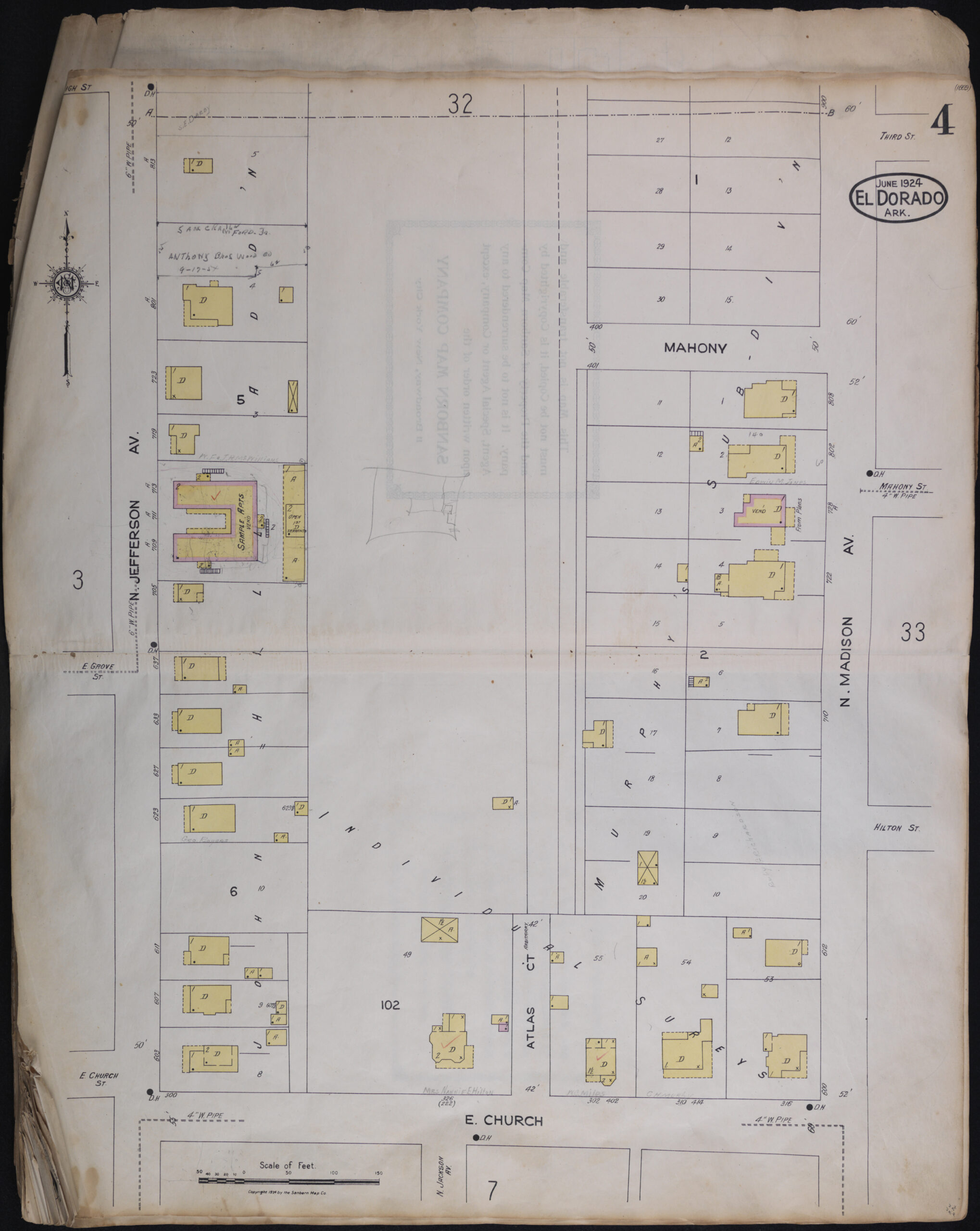
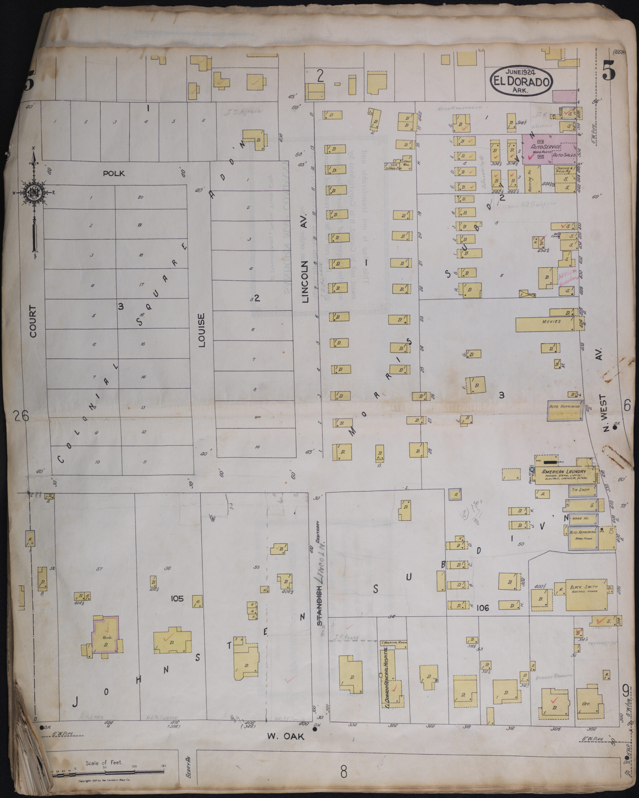
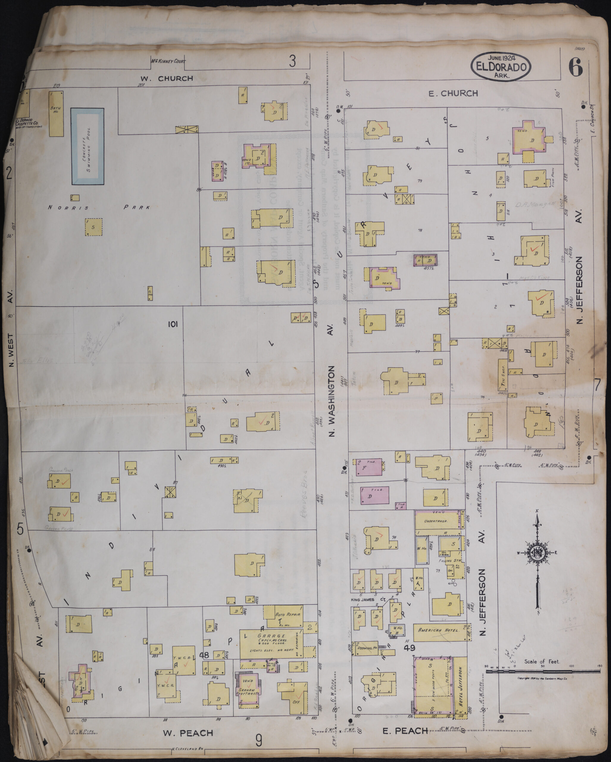
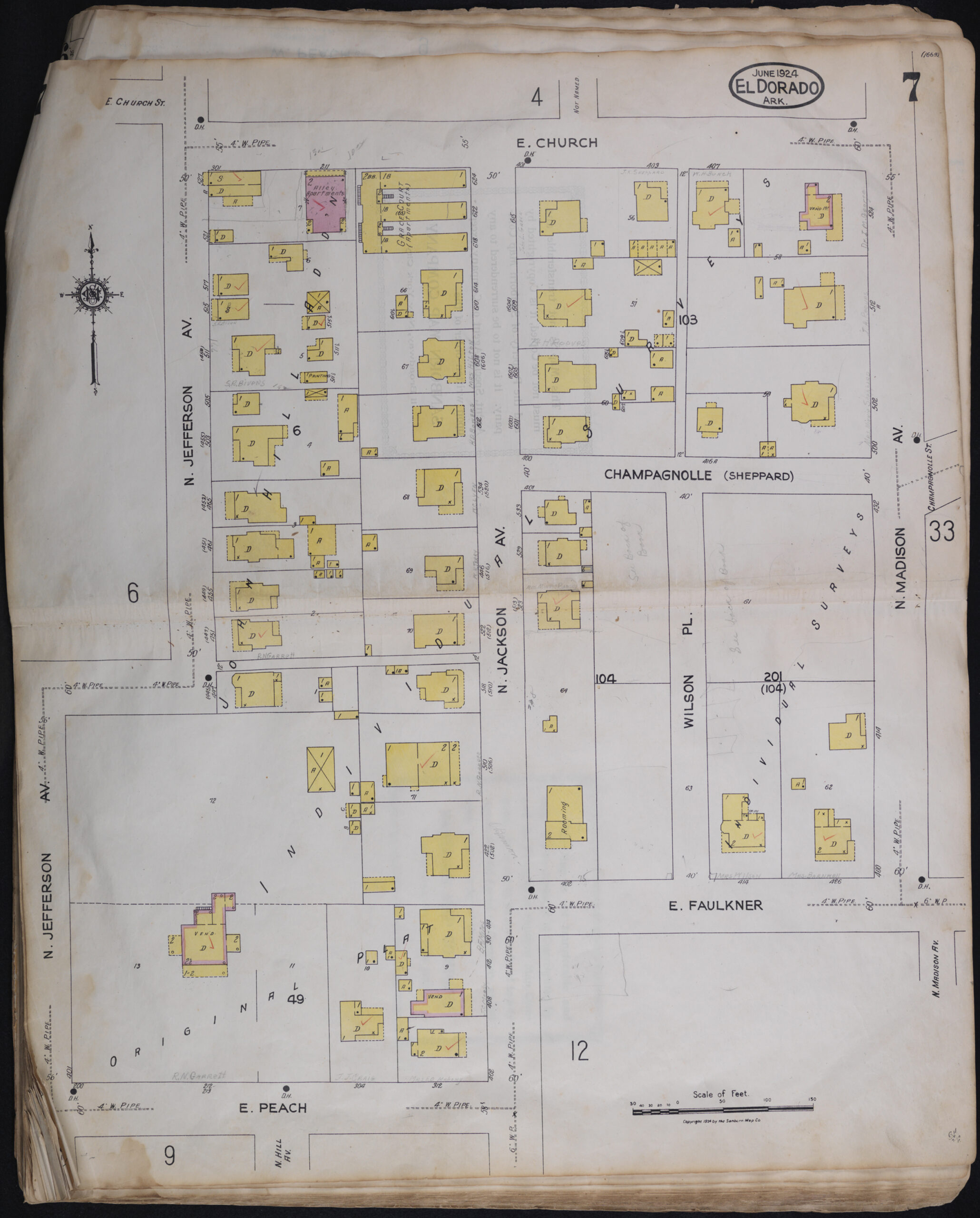
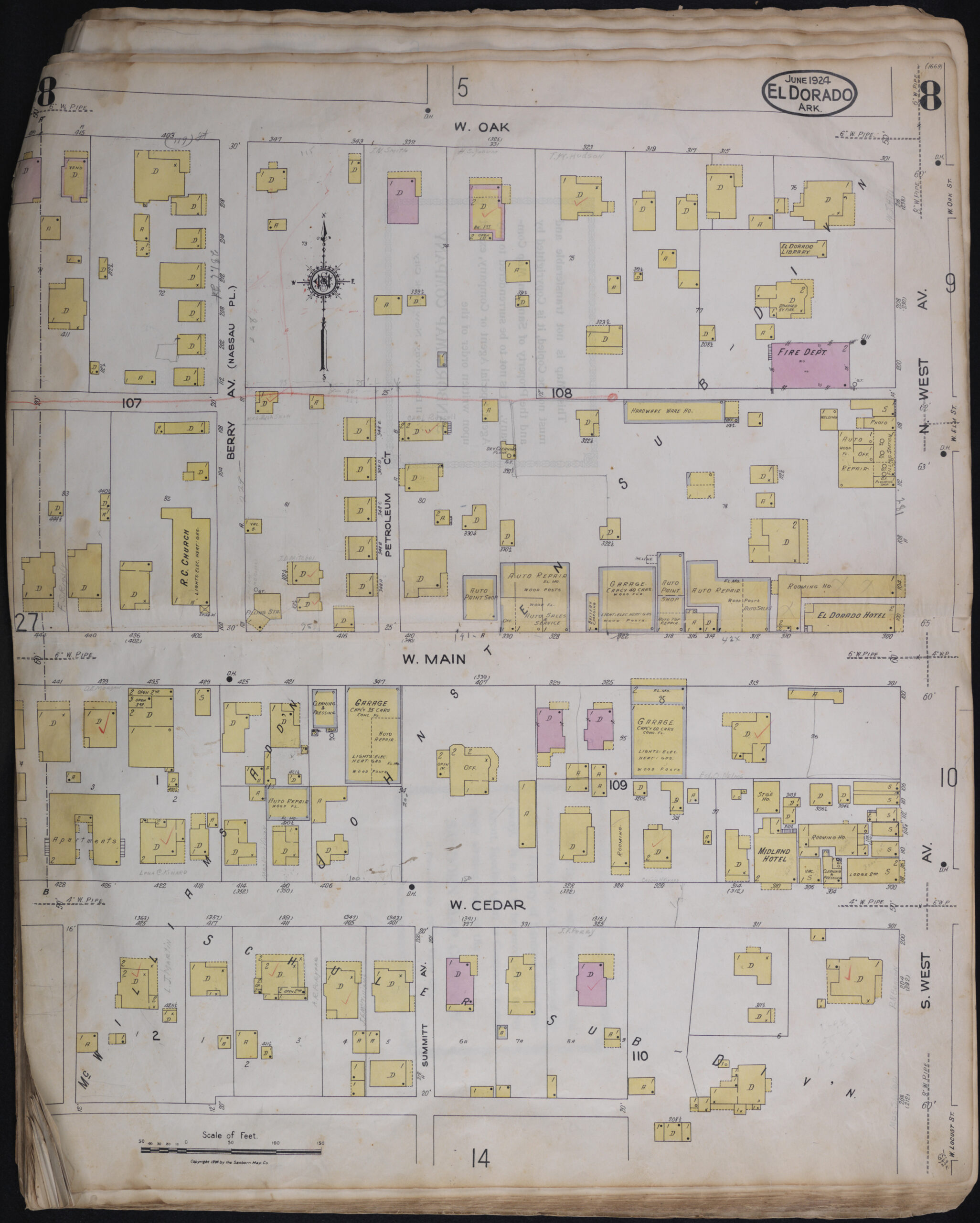
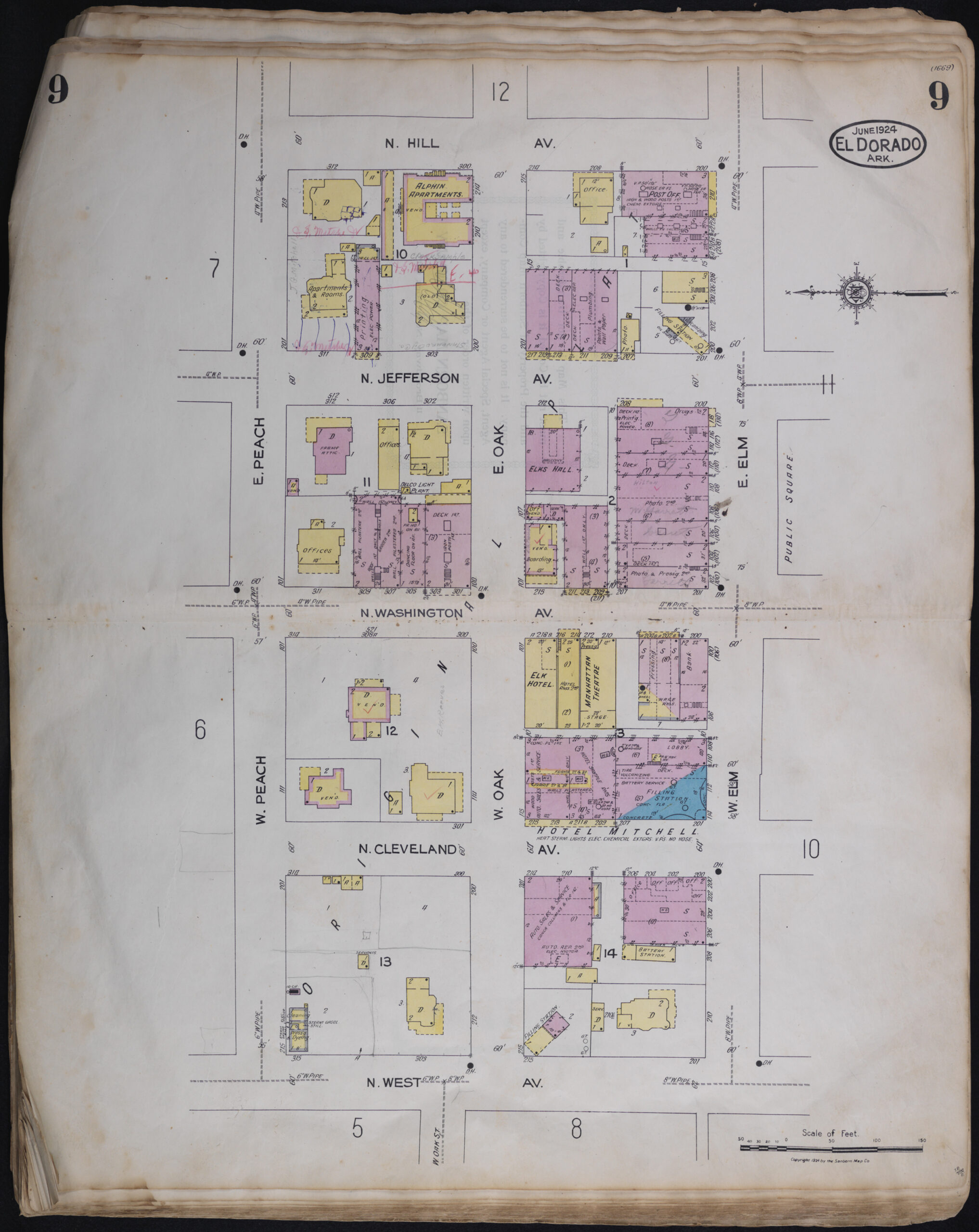
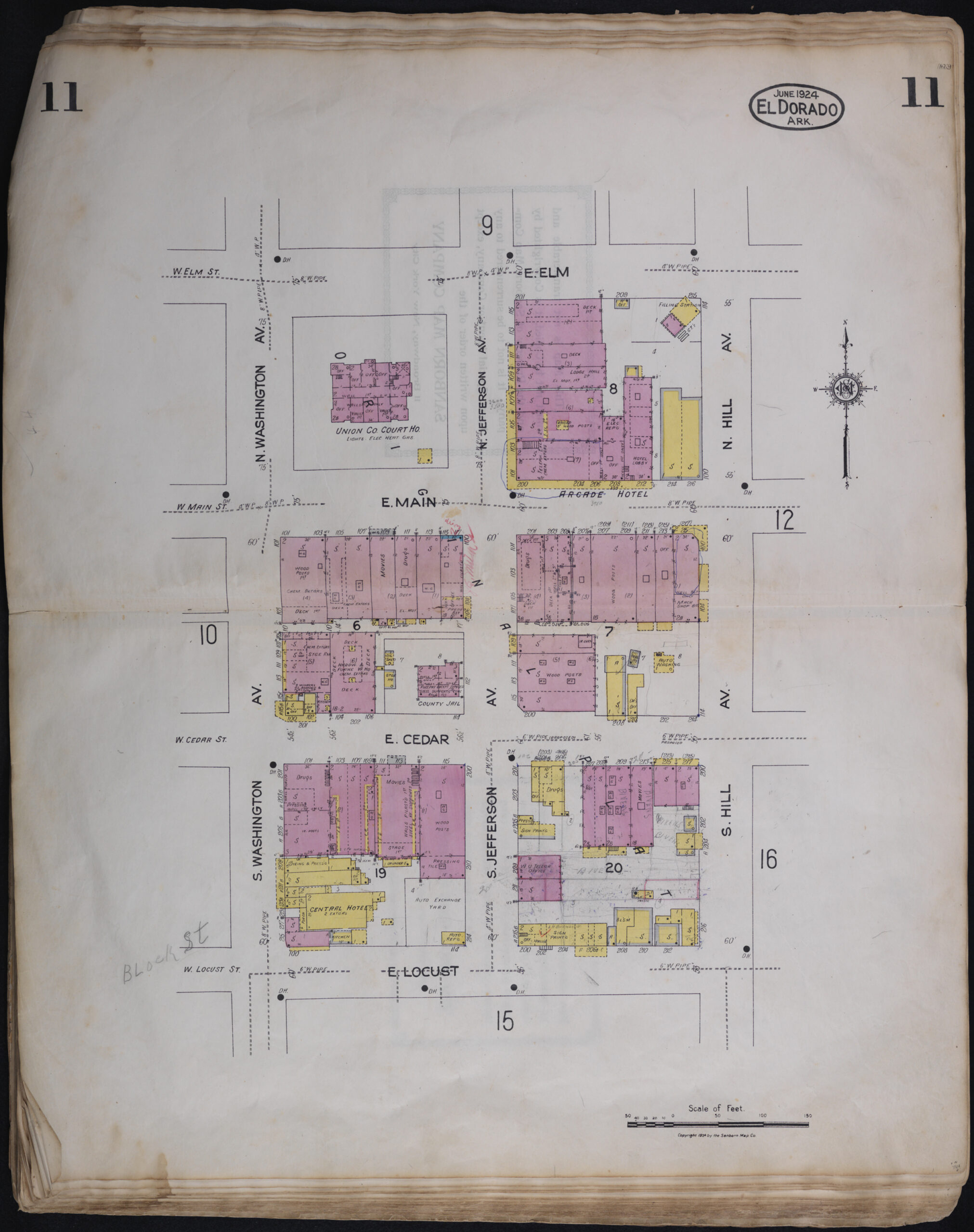
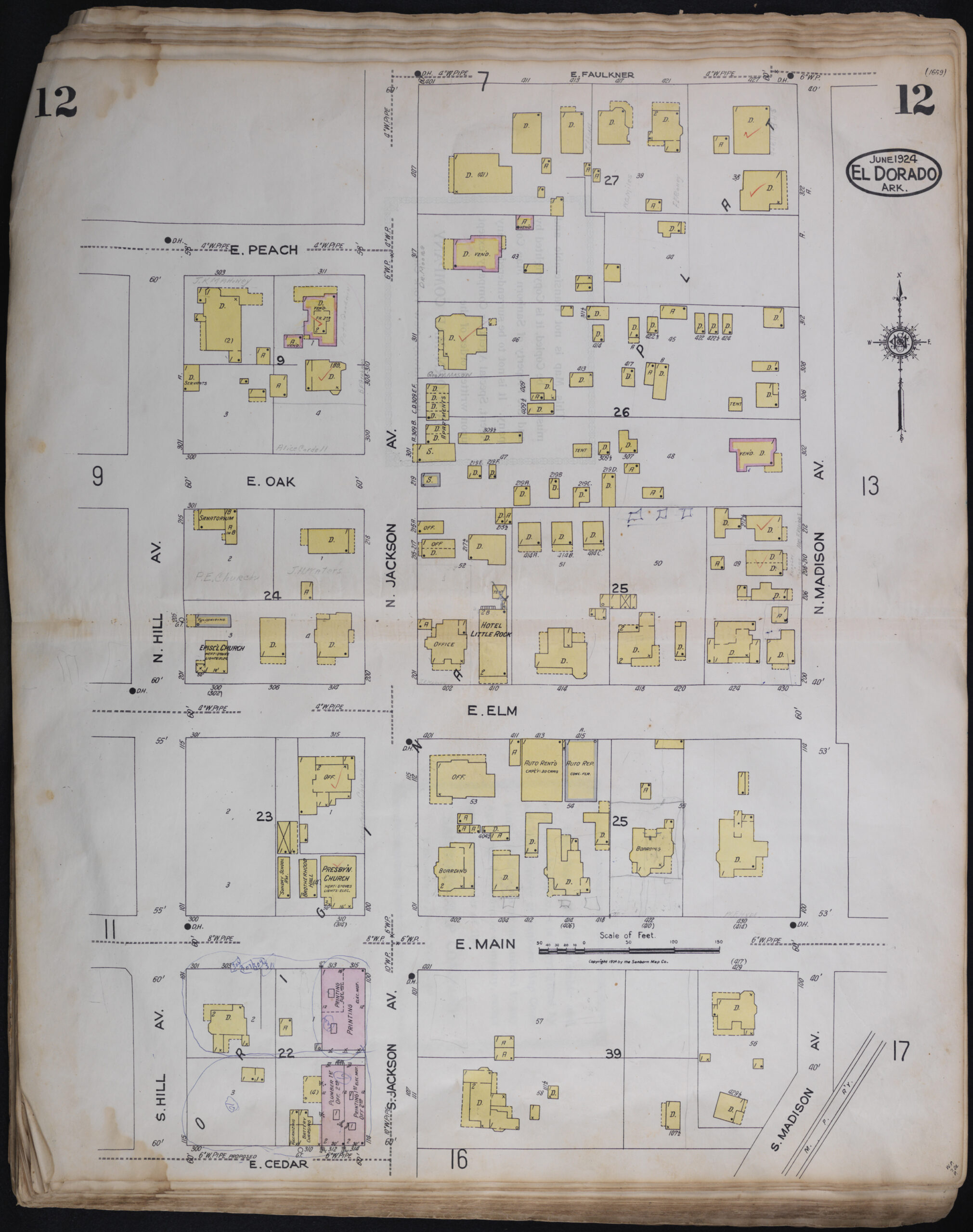
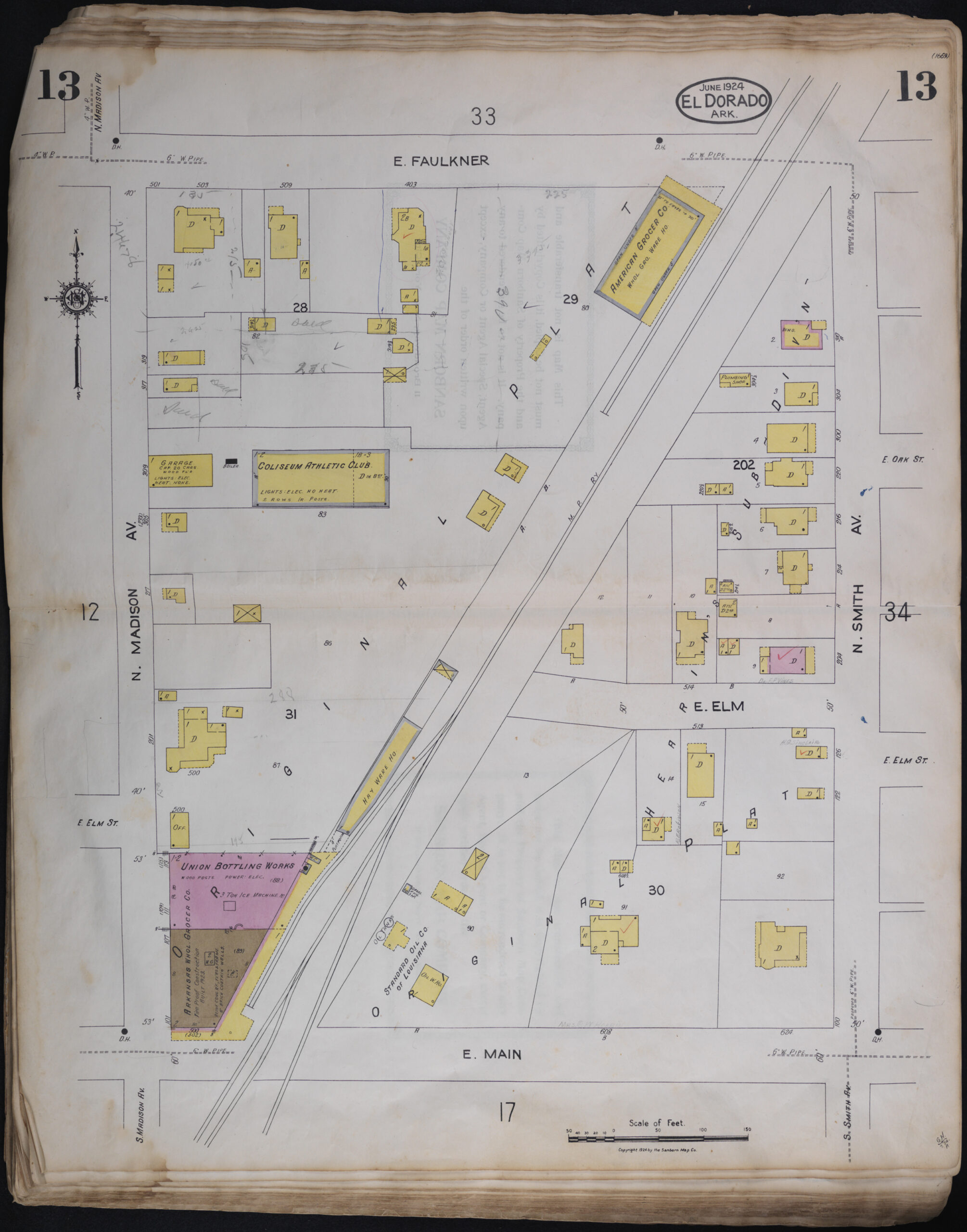
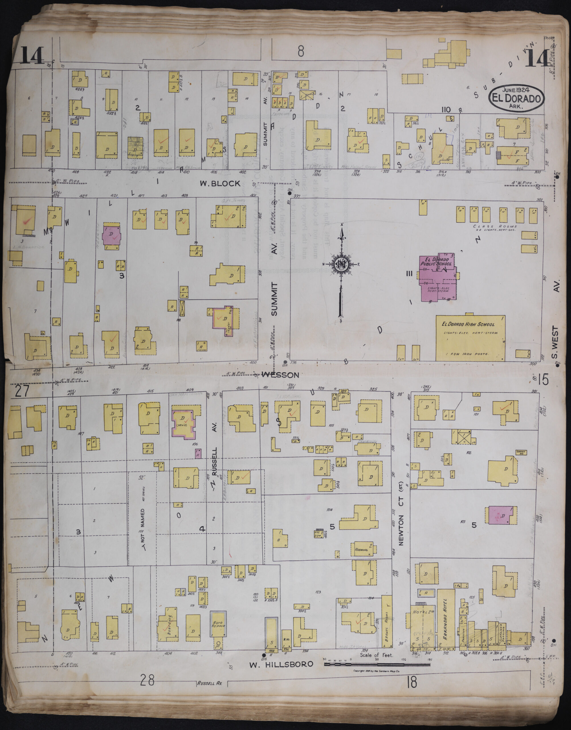
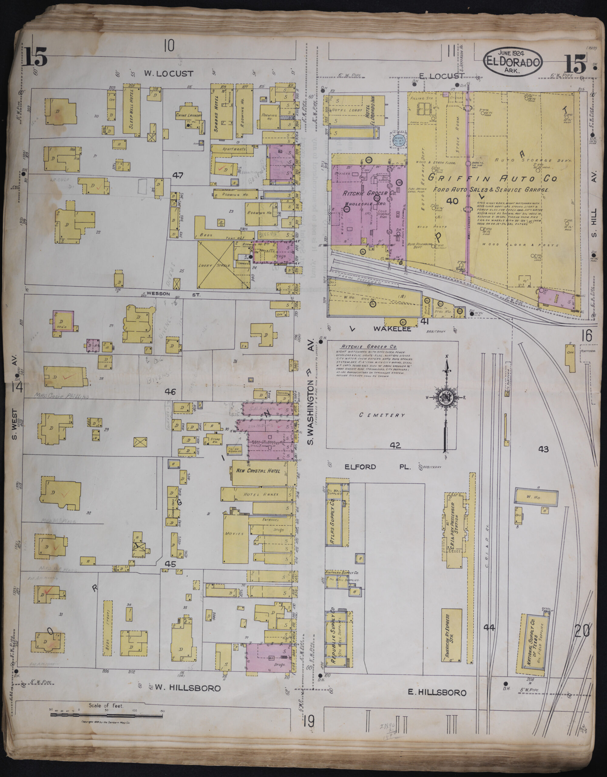
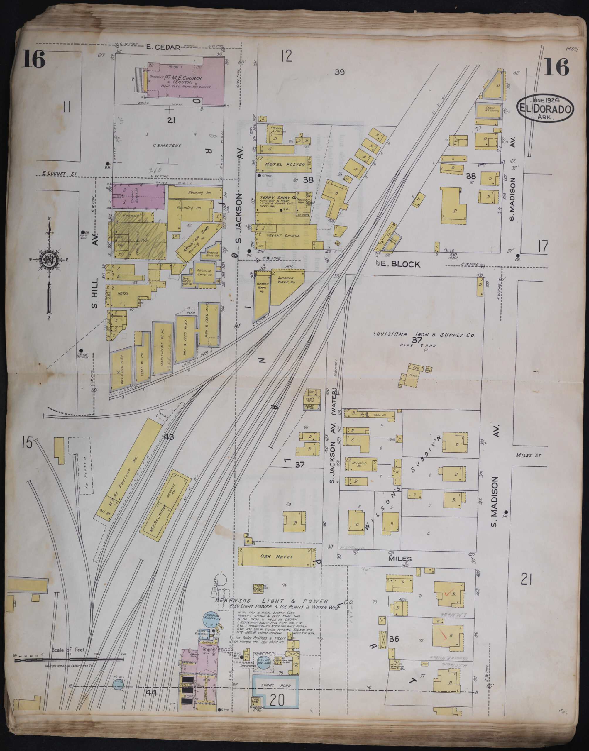
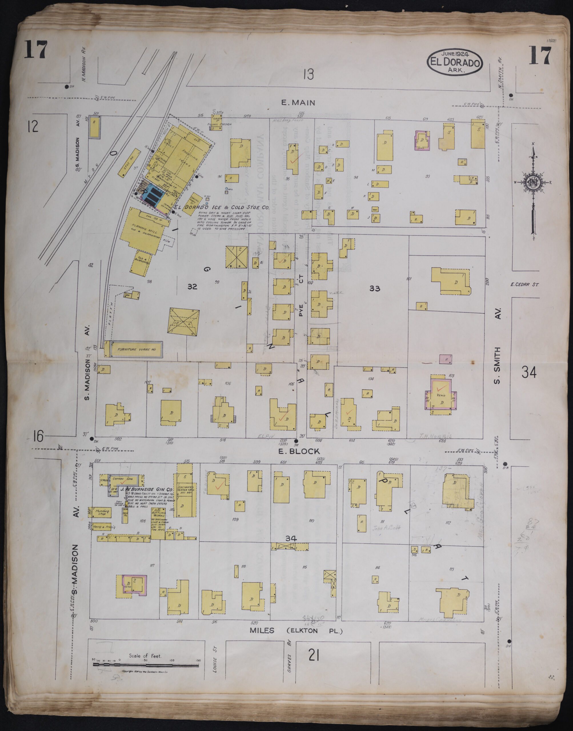
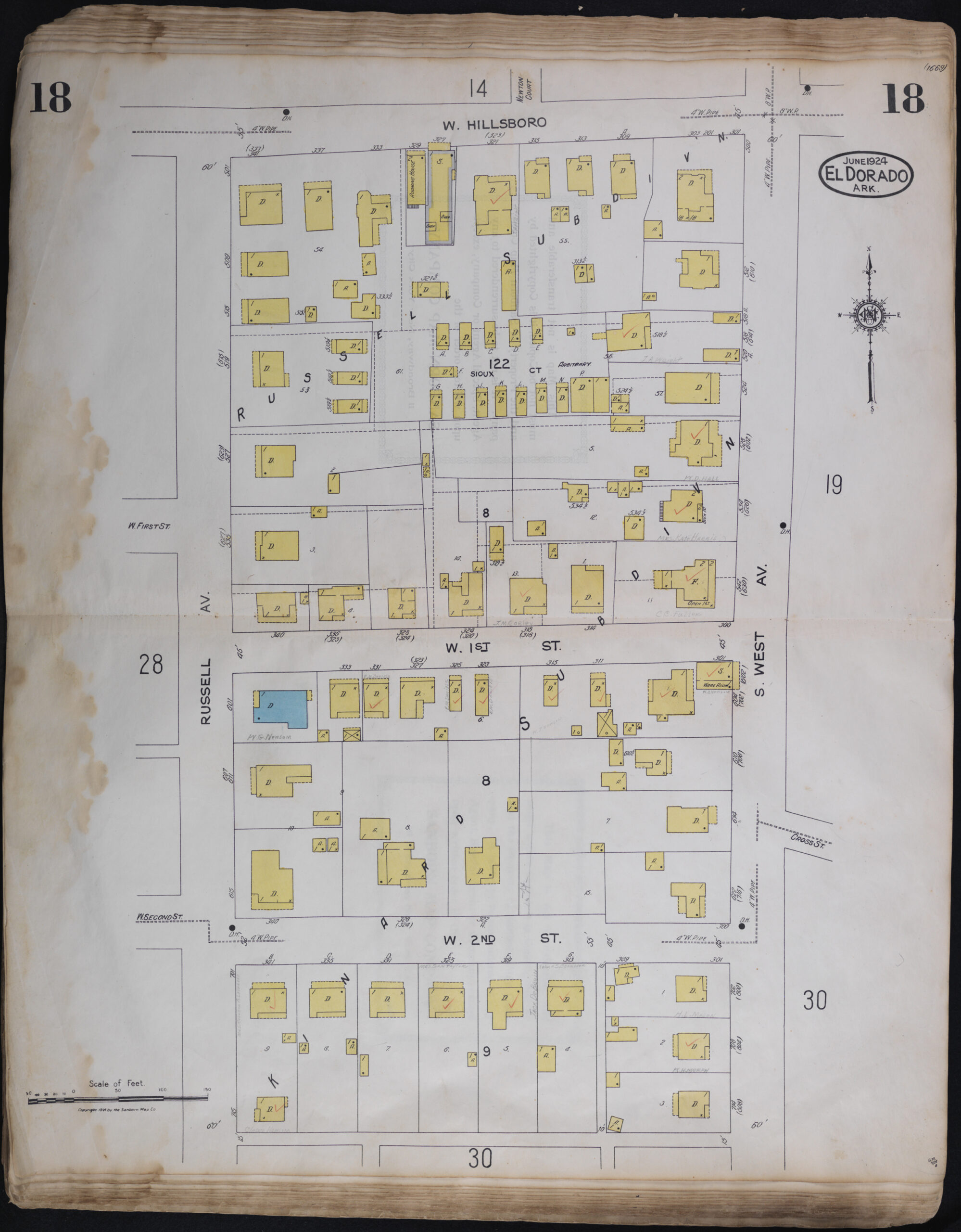
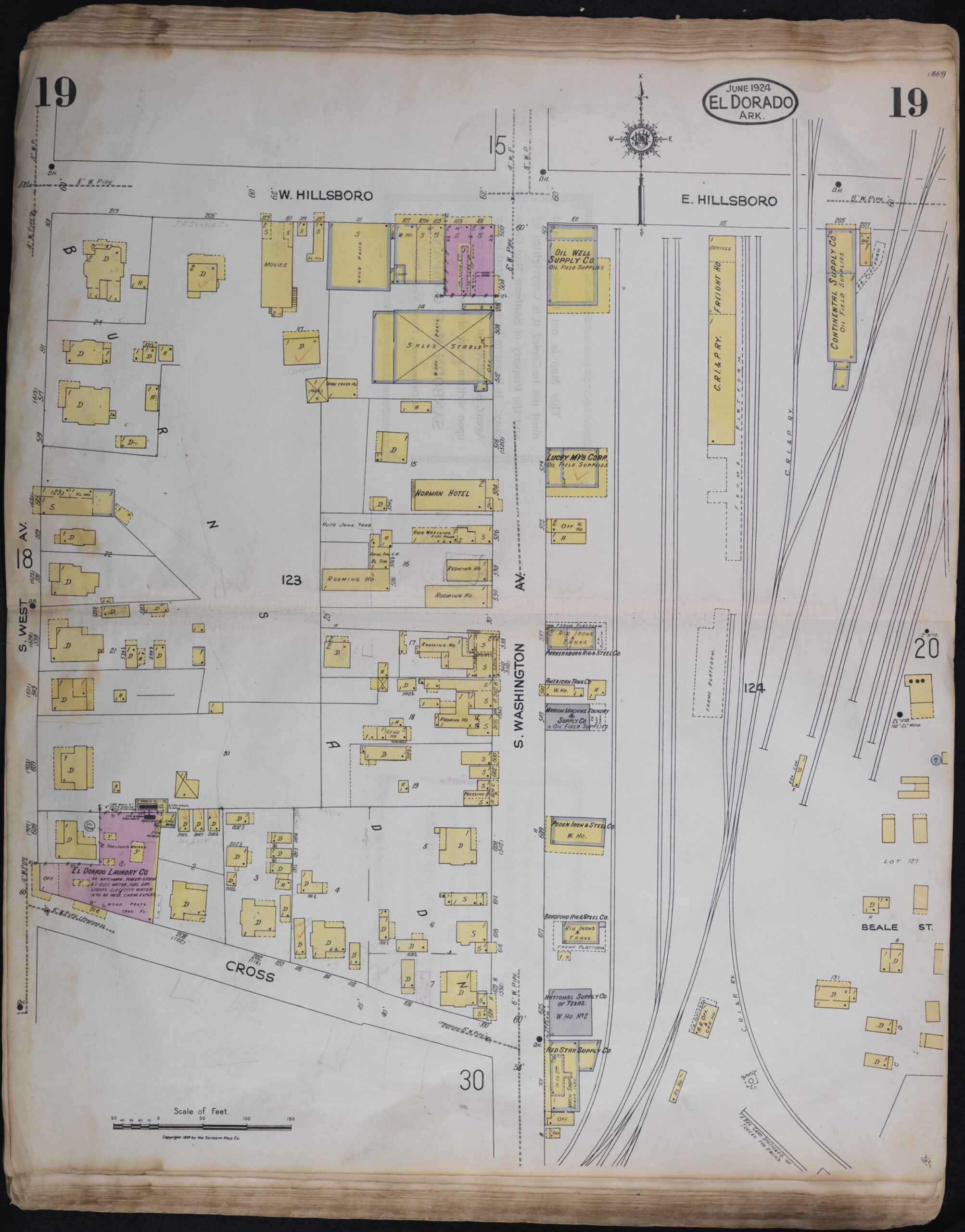
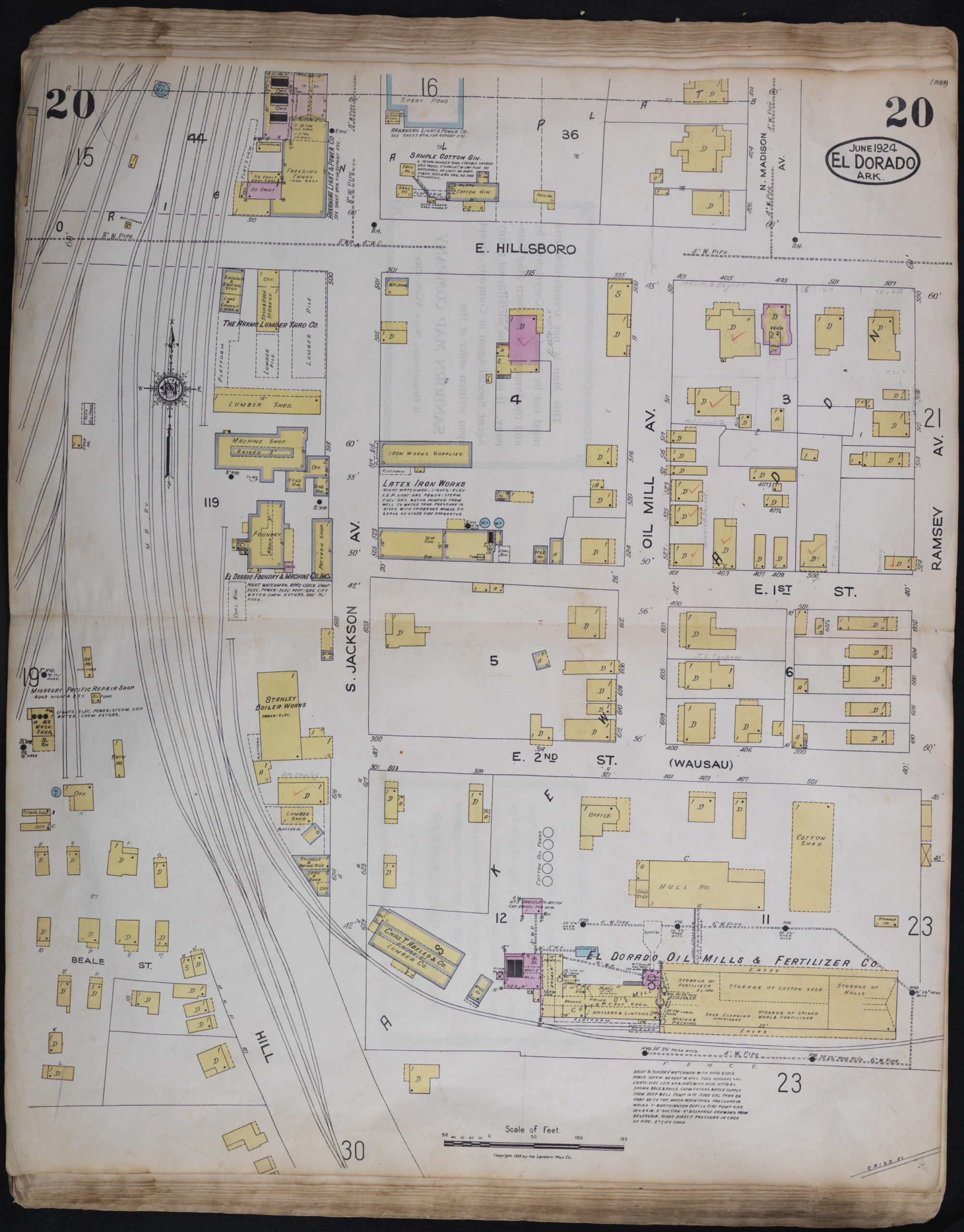
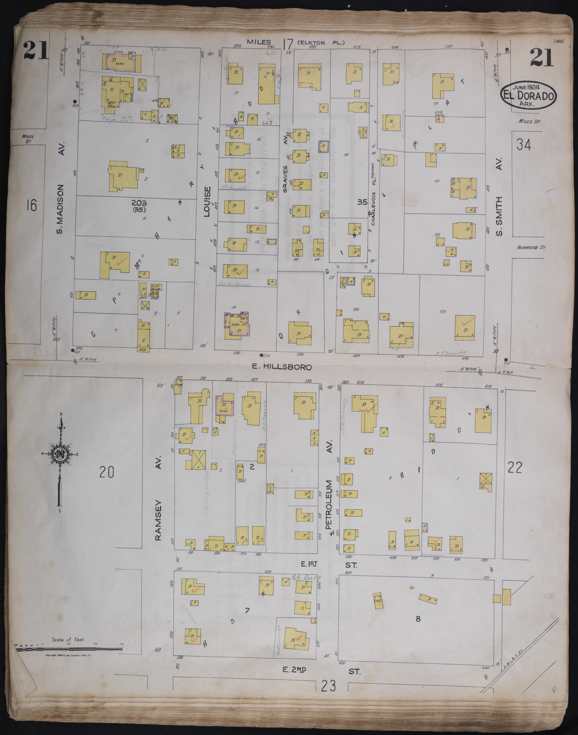
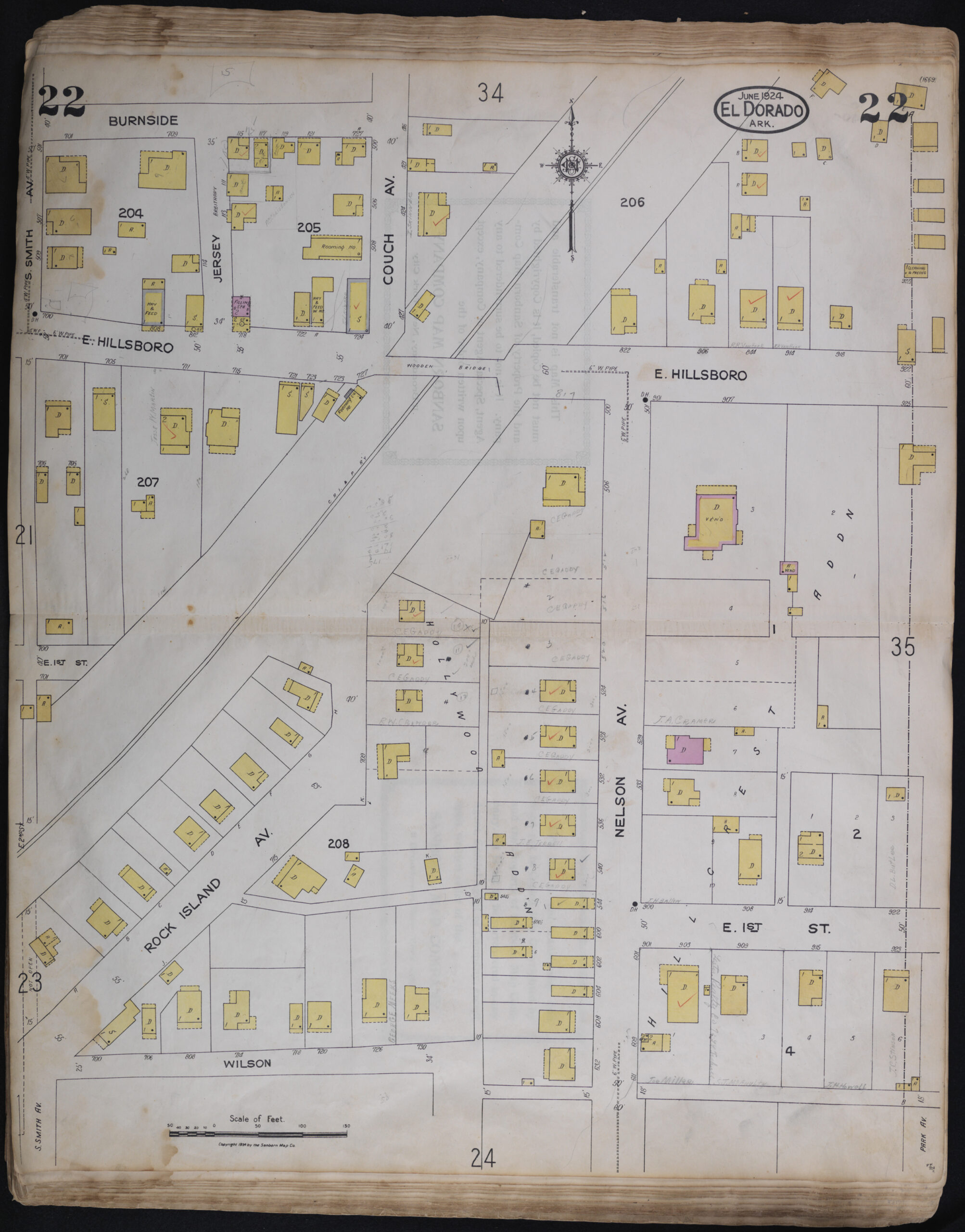
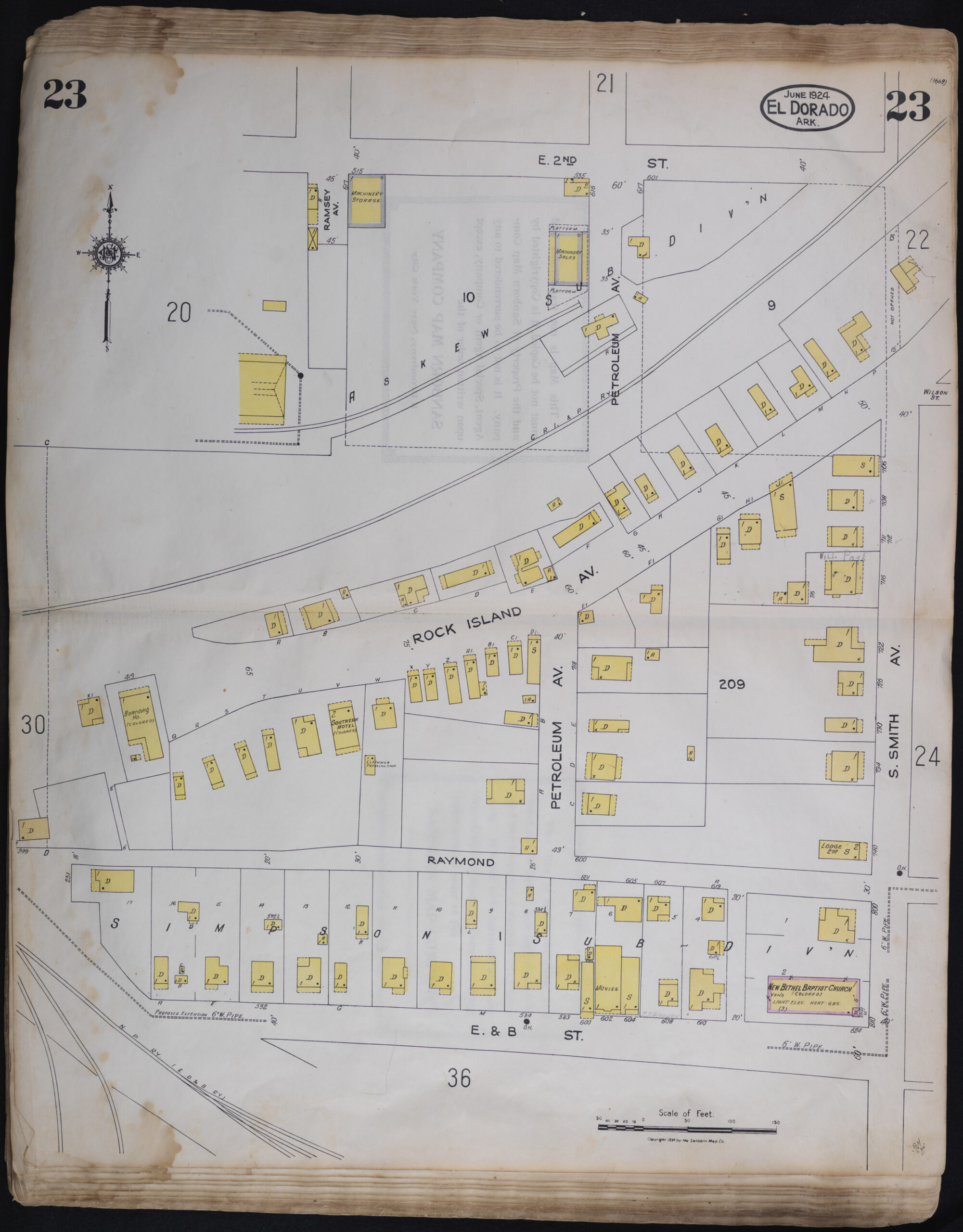
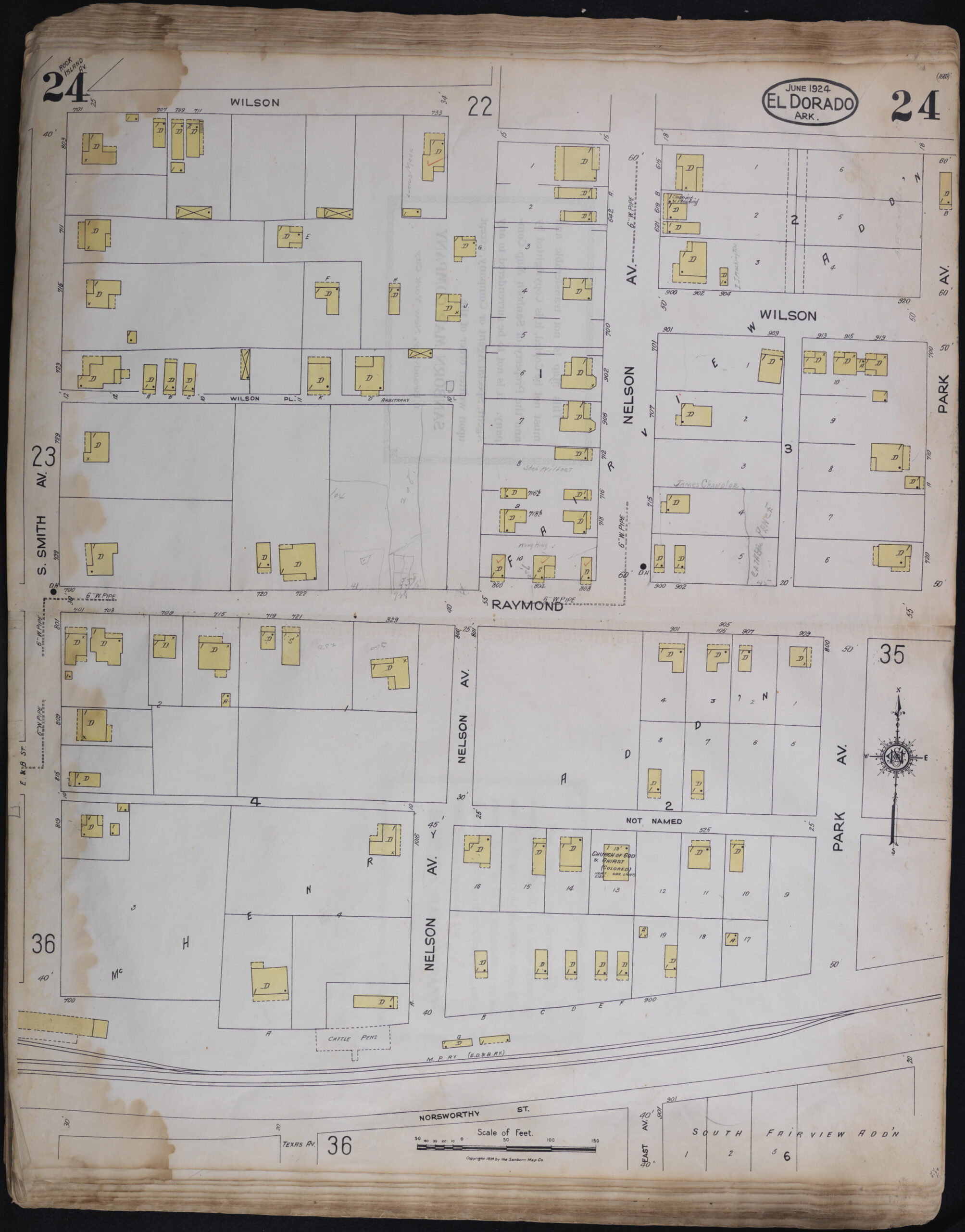
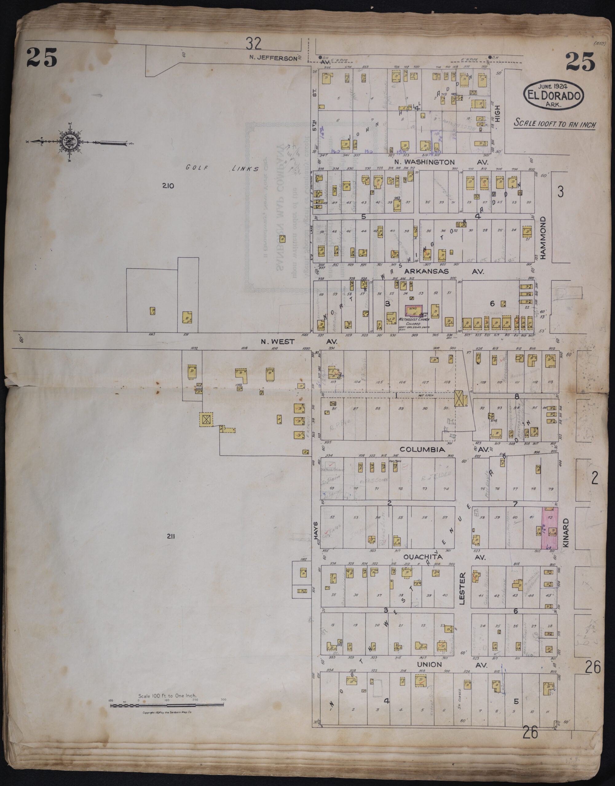
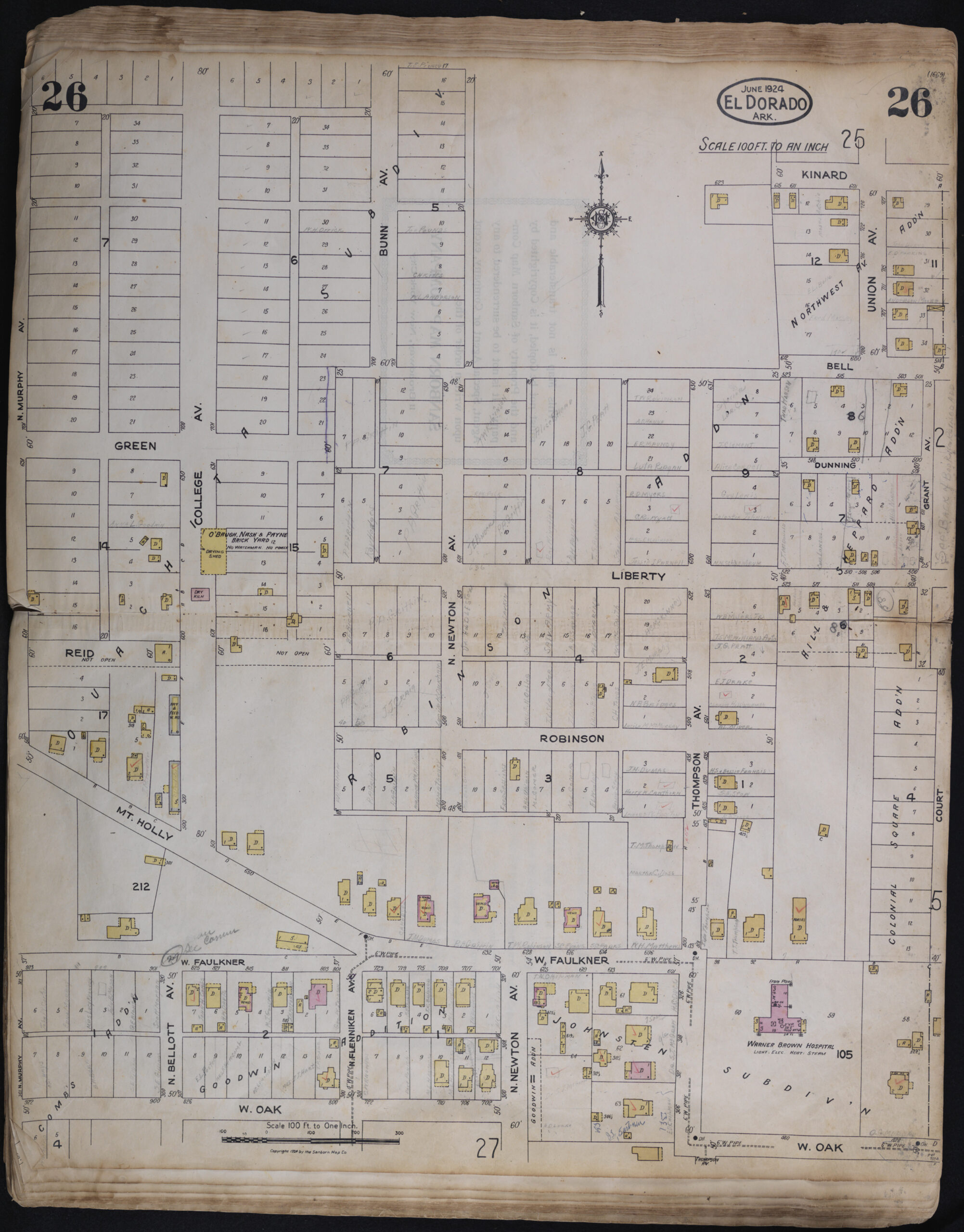
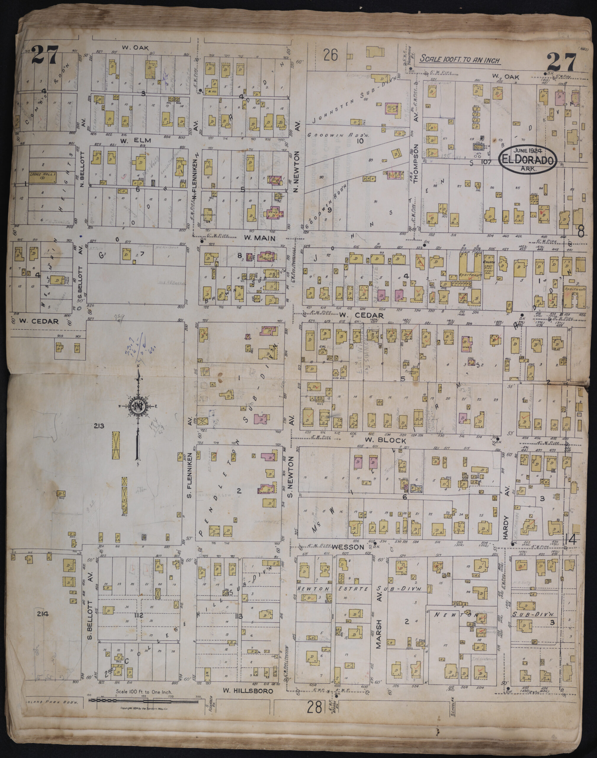
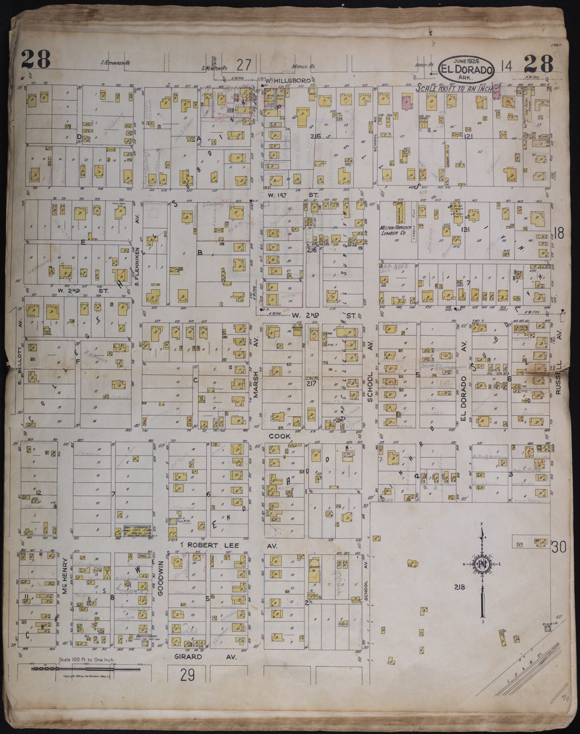
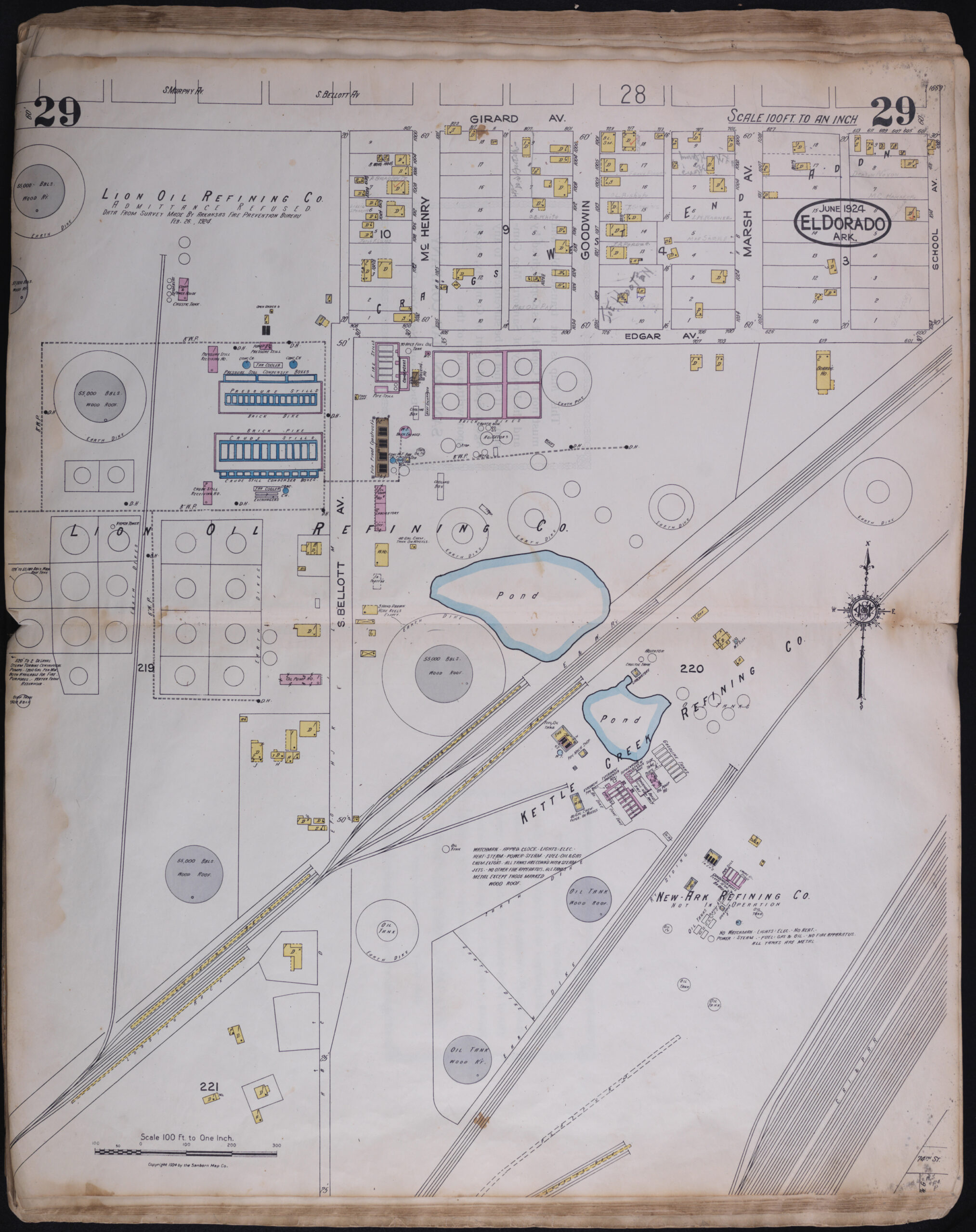
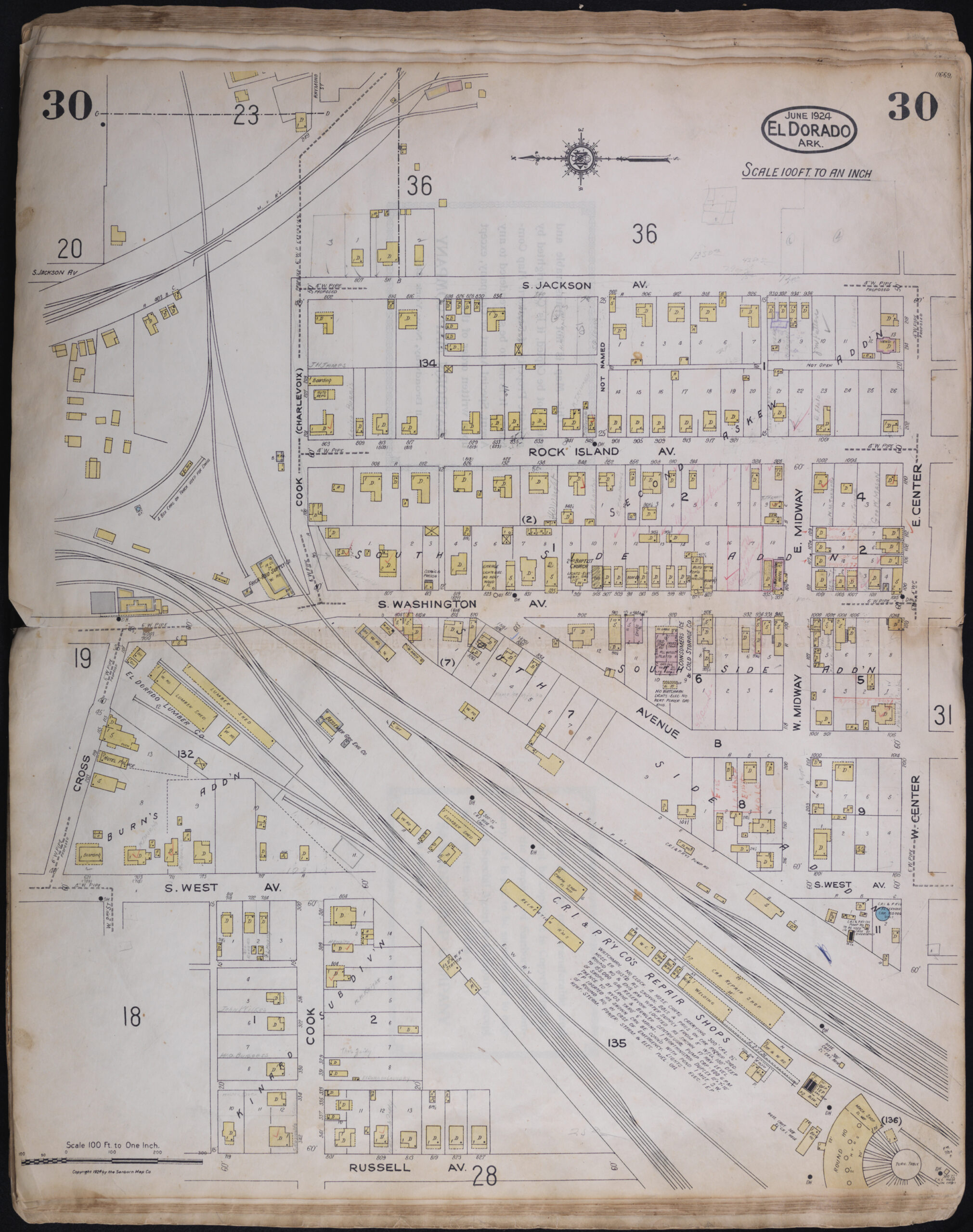
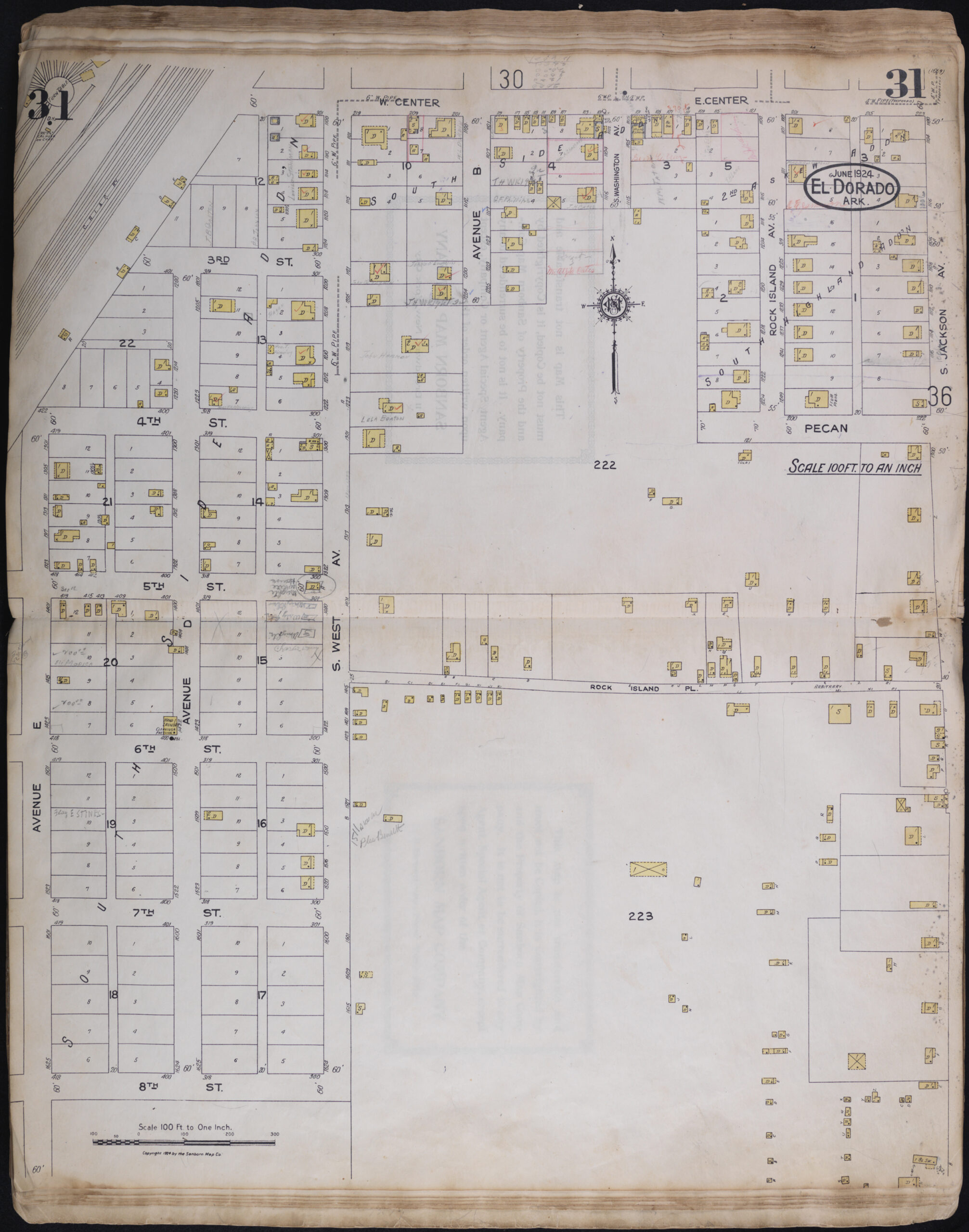
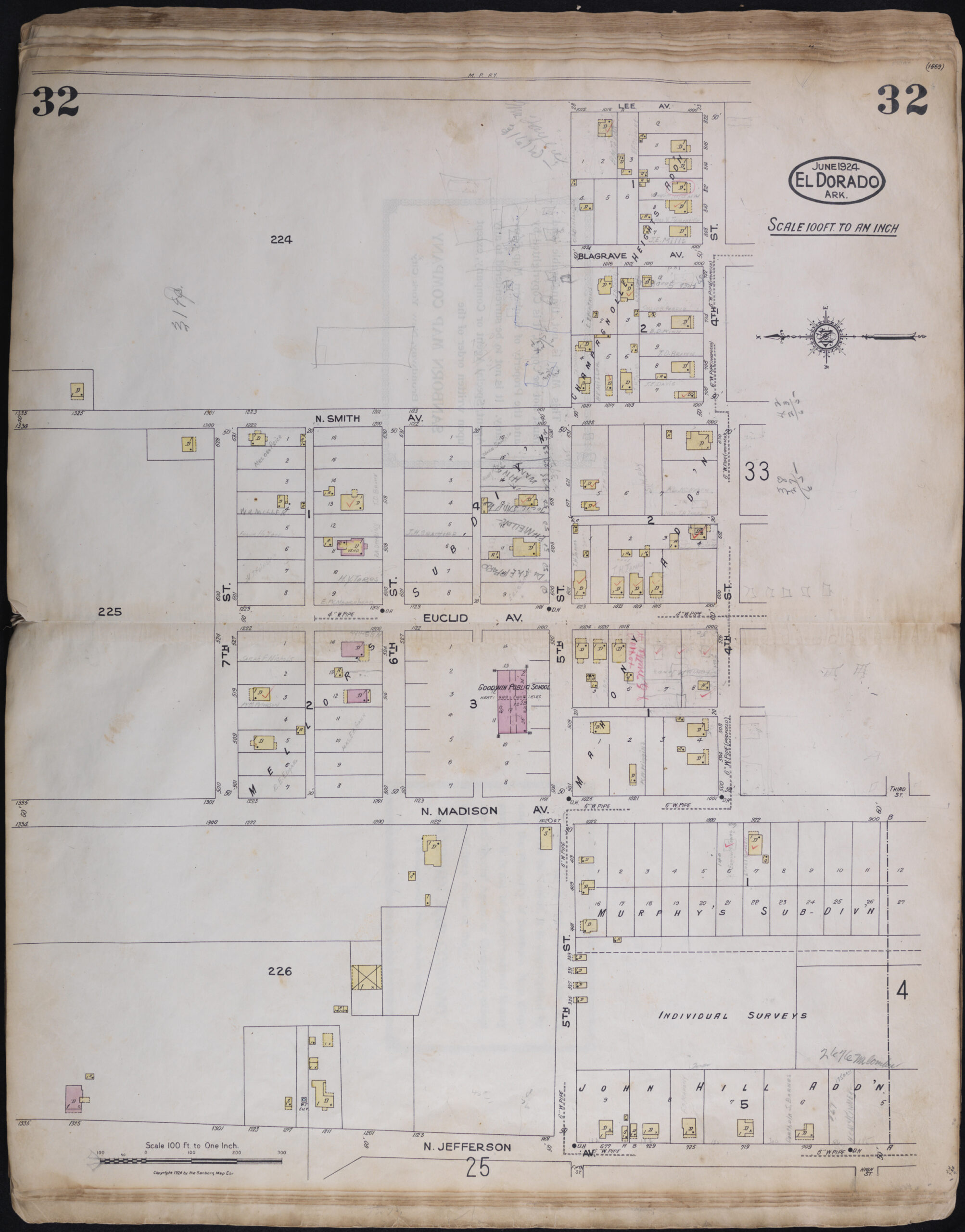
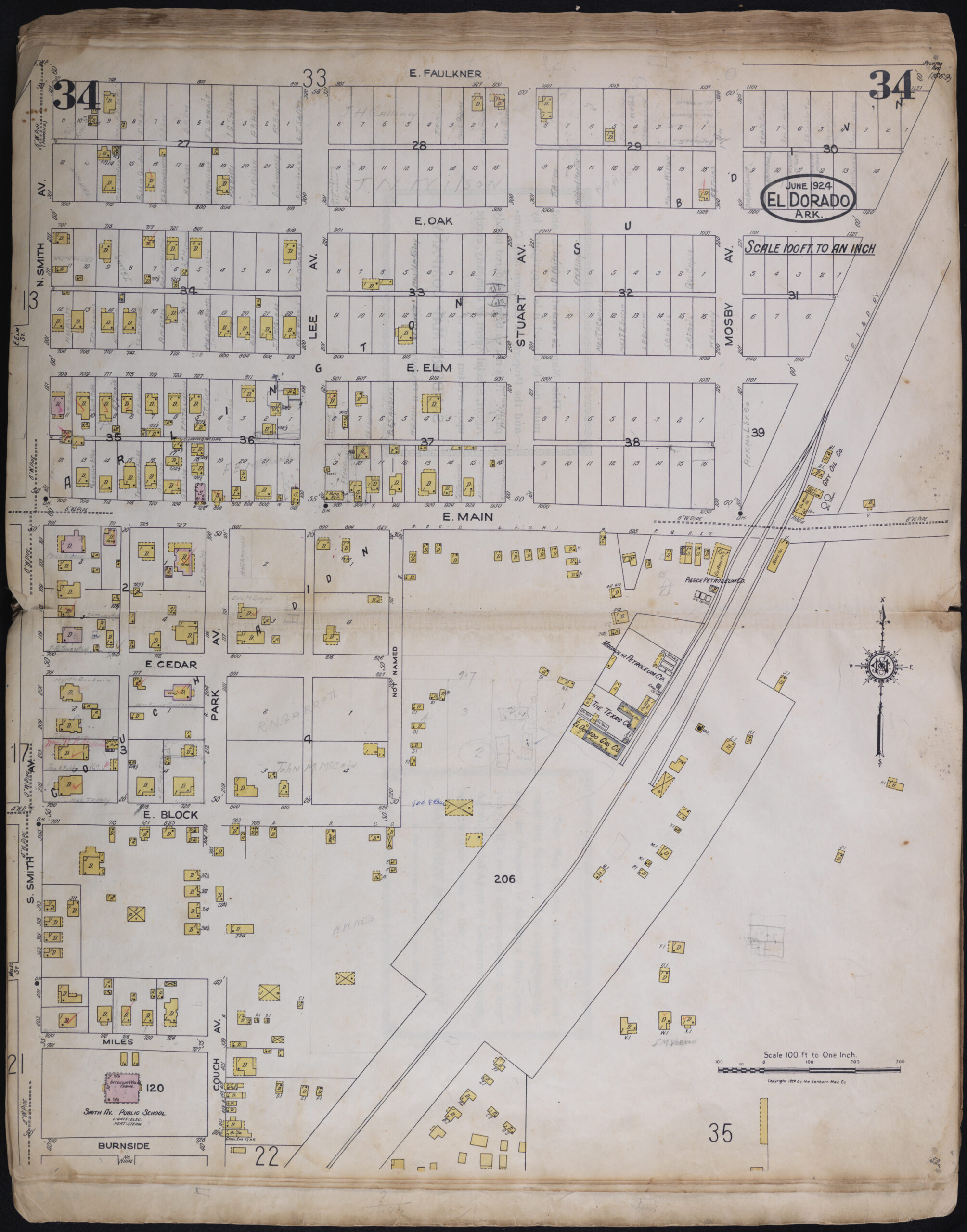
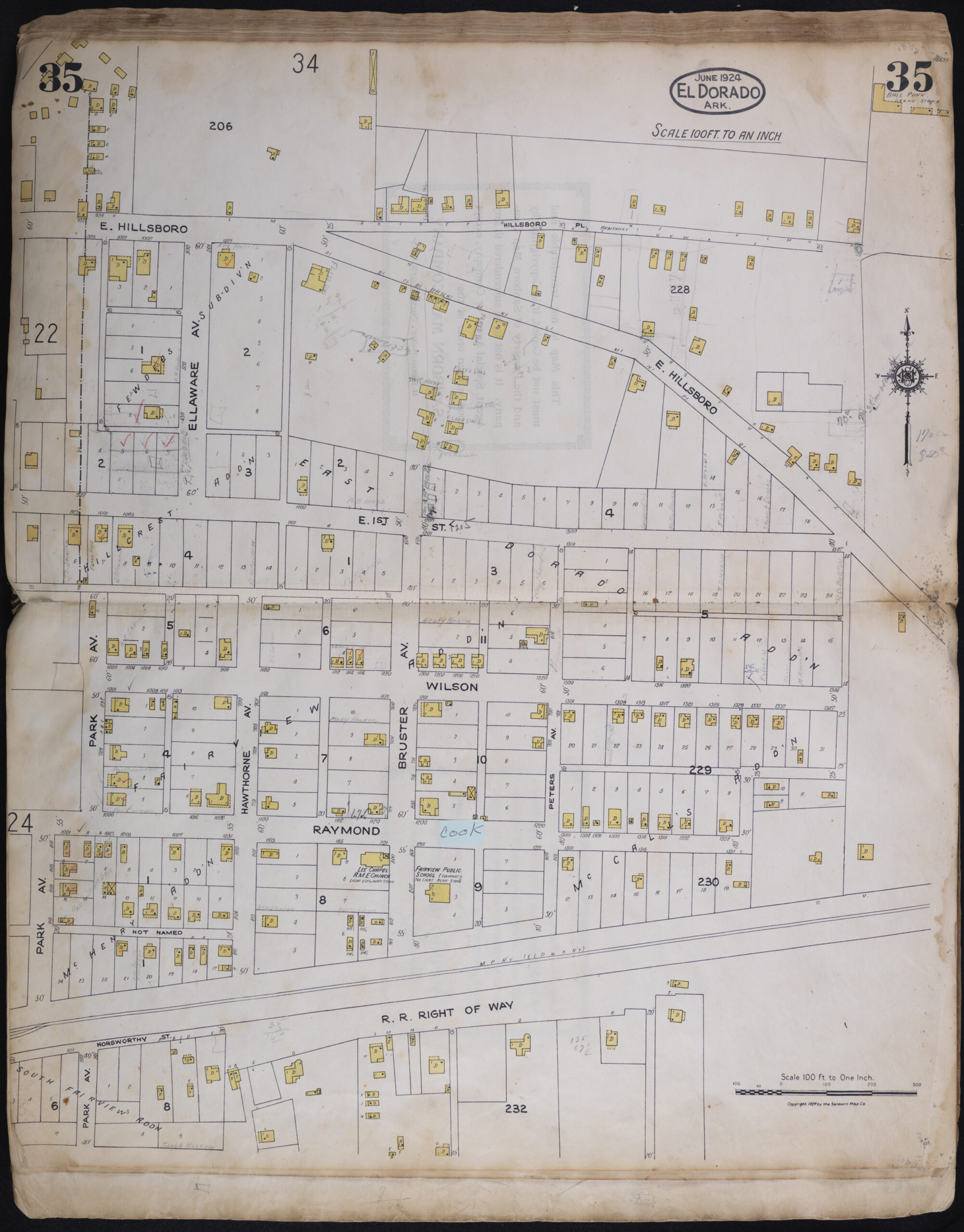
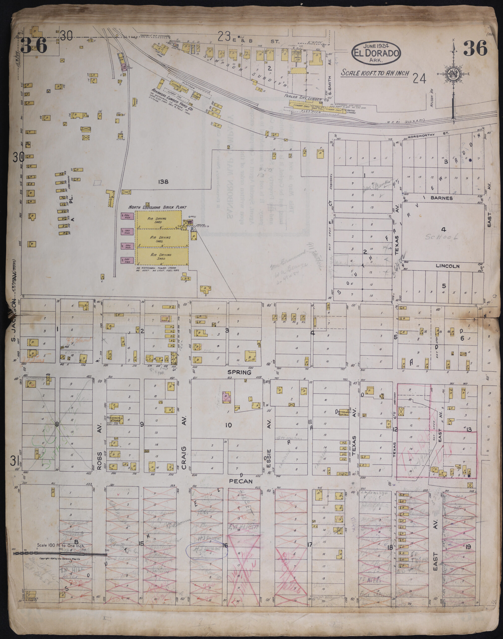
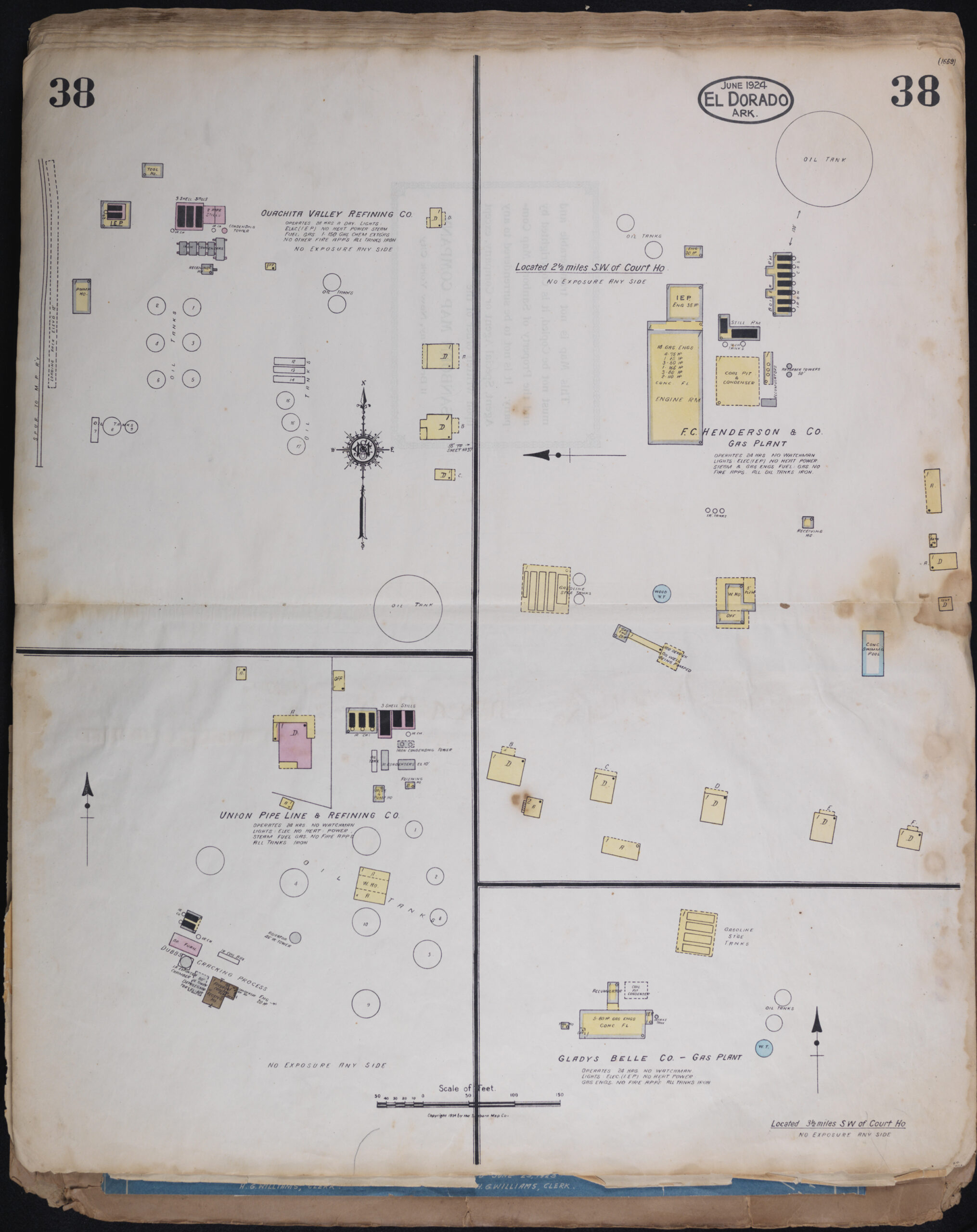
South Arkansas Historical Preservation Society has obtained a copy of June 1924 Sanborn map book of the City of El Dorado. Sanborn maps were designed by Surveyor D.A. Sanborn in 1866 to assist fire insurance agents in determining the degree of hazard associated with a particular property. The D.A. Sanborn Co. was the first company to offer insurance maps on a national scale in response to the growth of urban communities after 1850. The company’s surveyors meticulously documented the structural evidence of urbanization – building by building, block by block, neighborhood by neighborhood, community by community.*
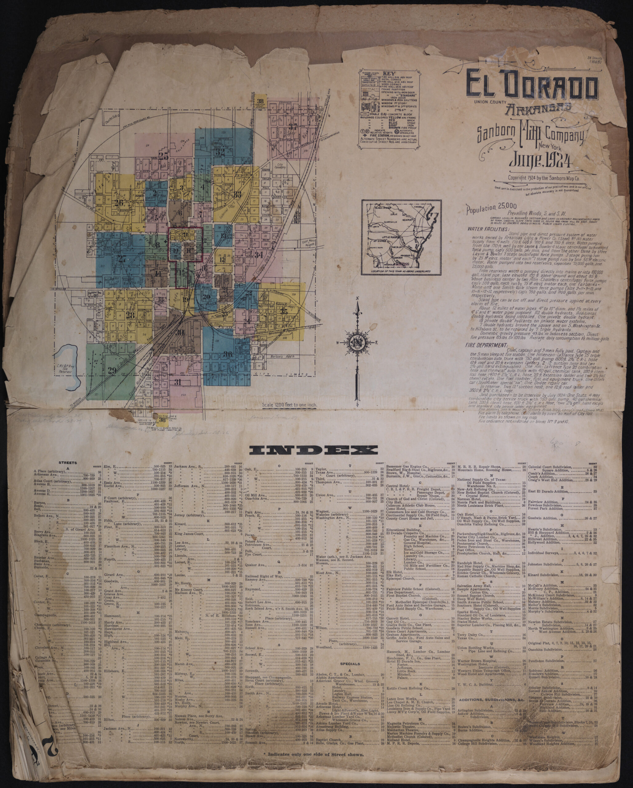
Each icon below will open its corresponding page in a window where you can zoom and pan to navigate around on the page. The first icon is the index where you can find your area or street of interest and click on the corresponding sheet number below, or advance to the page in the zoom window.
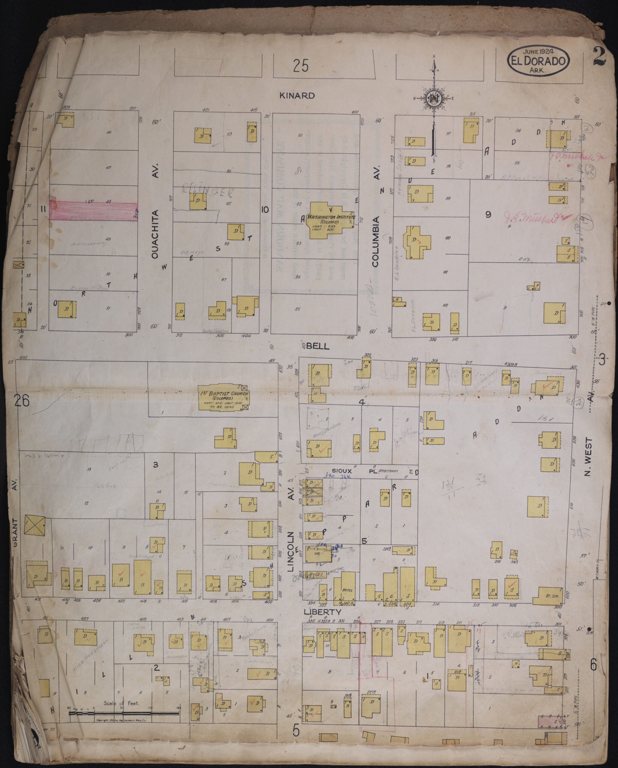
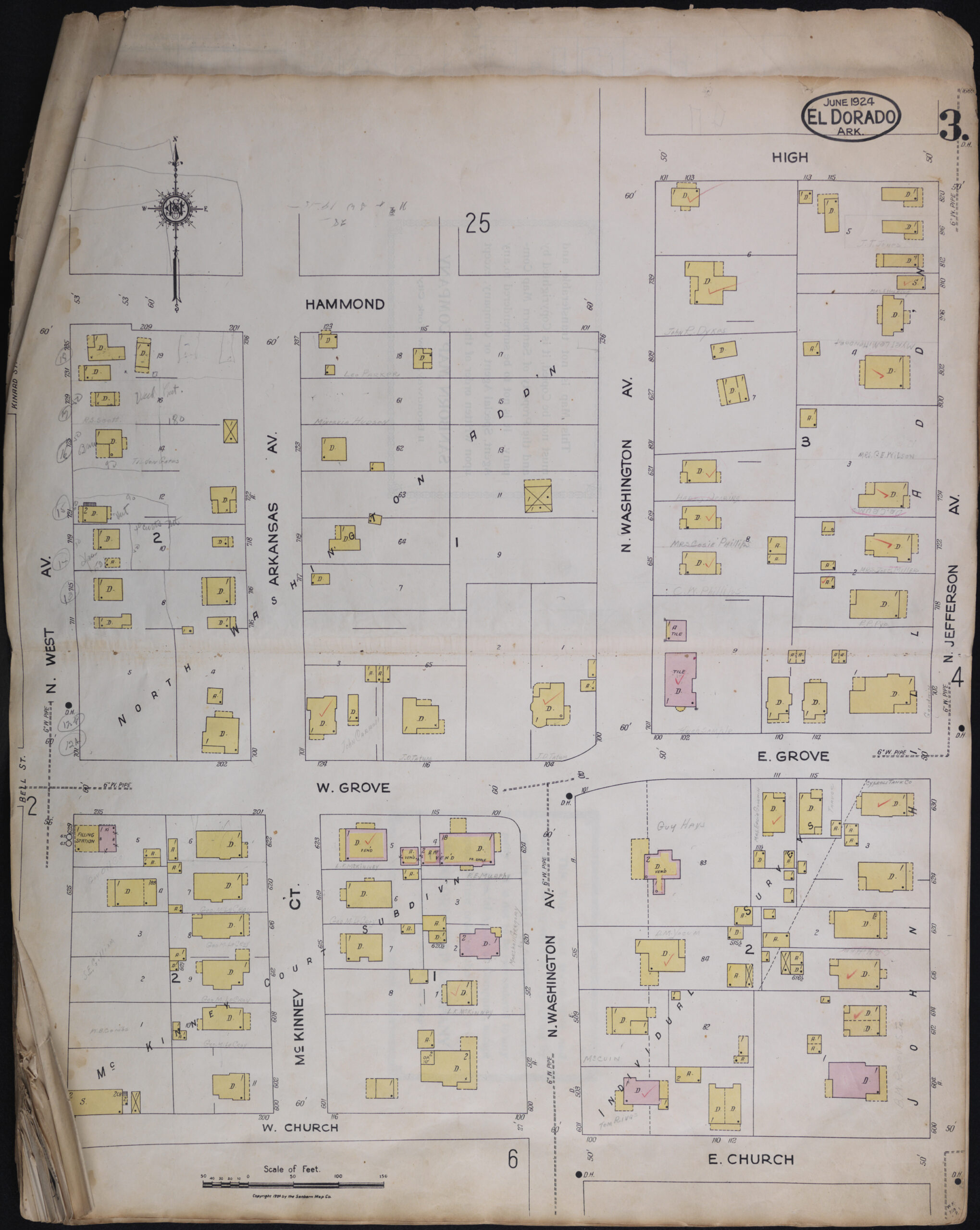
Please Note: This book contains ink or pencil notations by previous users/owners. The SAHPS cannot vouch for the accuracy of the information contained in these notations. Thank you for your understanding.
* Italicized excerpt was provided by The Marriott Library in Salt Lake City.
